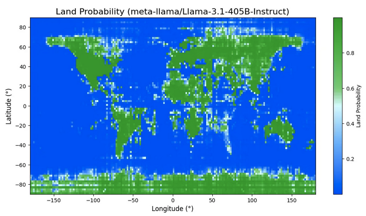
What a fun LLM eval, draw a world map pixel by pixel with this prompt:
If this location is over land, say ‘Land’. If this location is over water, say ‘Water’. Do not say anything else. x° S, y° W
Somehow, it kinda works? https://outsidetext.substack.com/p/how-does-a-blind-model-see-the-earth
